
By Dean Murray
A giant plume of dust is hitting the United States.
The mass is over 2,000 miles wide and 750 miles long, and has reached and is spreading over Florida as of Wednesday (June 4).
The phenomenon is due to a two to 2.5-mile-thick layer of the atmosphere, called the , crossing over the Atlantic Ocean.

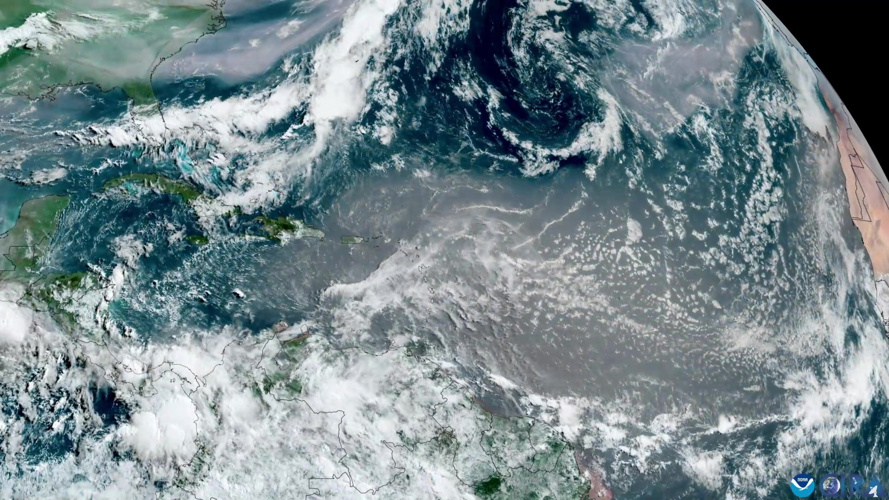
NOAA’s GOES-19 satellite captured this multi-day time-lapse imagery of the dust blowing thousands of miles across the Atlantic from May 28th to June 2. (NOAA/GOES-19 via SWNS)
Science agency has been closely monitoring the event from satellite, capturing detailed images that show the dust stretching from Africa, across the Atlantic, and toward the Caribbean and Florida.
Meteorologists say the dust can lead to hazy skies and vibrant sunsets, but can also temporarily suppress hurricane formation in the Atlantic.

(NOAA/GOES-19 via SWNS)
While most of the dust remains , some may reach ground level, affecting air quality in parts of the U.S. Southeast.
NOAA will continue to track the dust cloud as it moves, using satellite data to inform forecasts and keep the public updated.